Introduction
The Isle of Skye, with an area of 639 square miles, is Scotland's second largest island and famous for its dramatic mountain scenery. Besides the scenic expanses of heather moorland, hikers enjoy the beautiful and interesting terrain of the the Cuillin hills and the Quiraing. The island lies to the northwest of the mainland, forming part of the Inner Hebrides. Its coastline is a series of peninsulas and bays fanning out from a center dominated by the Cuillin. Located on the island are several ruins and other archaeological points of interest, particularly on the uninhabited peninsula of Rubha an Dùnain.
Facts
- As of 2011 Skye's population was recorded at a little over 10,000.
- Before the 1920s, most of the island's population spoke Scottish Gaelic; today only around 30% speak the language.
- The island's fauna includes dolphins, porpoises, Atlantic salmon, basking sharks, minke whales, seals, otters, golden eagles, white-tailed sea eagles, herons, greylag geese, puffins, gannets, deer, and the American mink.
- Crofting, a type of small-scale faming, generally on rented land, is an important part of the island's economy and community structure.
- Completed in 1995, the Skye Crossing connects the Isle of Skye to the Scottish mainland.
- Castles of Skye (many now ruins) include Dunvegan Castle, Caisteal Chamuis (or Knock Castle), Dunscaith, and Caisteal Maol.
- The Isle of Skye is home to Sabhal Mòr Ostaig, an entirely immersive Scottish Gaelic college and influential cultural center.
Geographic Highlights

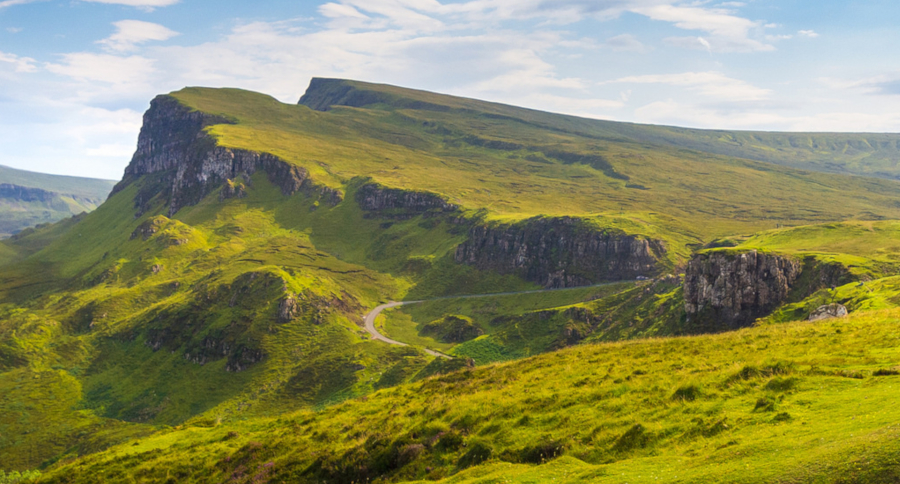
"Quiraing" by seth m
The Quiraing
The Quiraing (in Gaelic: A' Chuith-Raing) is a landslip on the eastern face of Meall na Suiramach, the northernmost summit of the Trotternish. The whole of the Trotternish Ridge escarpment was formed by a great series of landslips; the Quiraing is the only part of the slip still moving.
A number of landmarks along of the distinctive landscape have earned nicknames for their appearance, such as the Needle, a tall, jagged pinnacle; the Table, a flat grassy area slipped down from the summit plateau; and the Prison, a pyramidal rocky peak which resembles a medieval keep when viewed from the right angle.
The name Quiraing comes from Old Norse 'Kví Rand', which means "Round Fold". Within the fold is The Table, an elevated plateau hidden amongst the pillars. It is said that the fold was used to conceal cattle from Viking raiders.

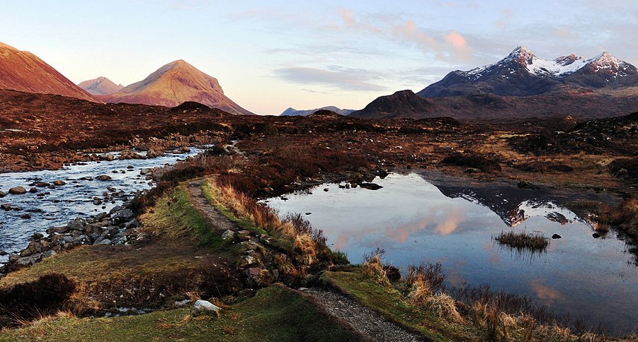
"The Cuillin mountains viewed from Sligachan." by Andrewmckie
The Cuillin
The Cuillin (Scottish Gaelic: An Cuilthionn or An Cuiltheann) is a range of rocky mountains sprawling across the southeast region of the island. The main Cuillin ridge is also known as the Black Cuillin to distinguish it from the Red Cuillin, which lie to the east of Glen Sligachan. The Cuillin is one of Scotland's 40 designated national scenic areas.
Comprised of rough gabbro (which lend the ridge darker color) and slippery basalt, the Black Cuillin is an appealing challenge for mountaineers. The highest point of the Cuillin, and of the Isle of Skye, is Sgùrr Alasdair in the Black Cuillin at 3,255 ft.
The Red Cuillin (na Beanntan Dearga), also called the Red Hills, are mainly composed of granite, giving the hills a paler and slightly reddish appearance. These hills are more rounded and easier to hike.

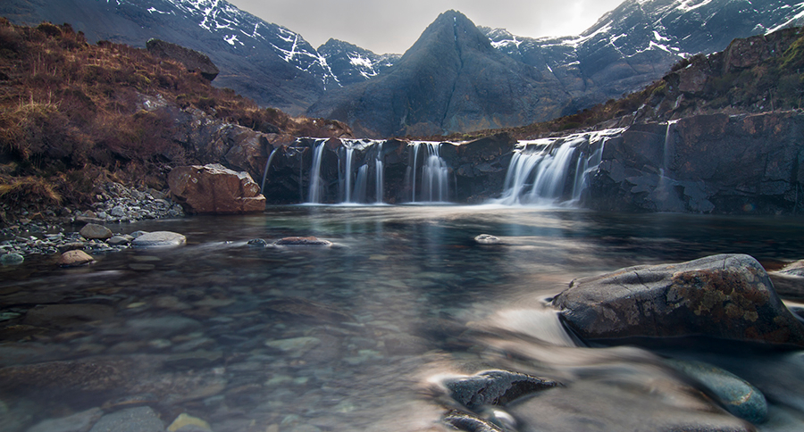
Fairy Pools
The Fairy Pools are a beautiful collection of pools, streams, and waterfalls surrounded by the Glen Brittle forest. The cool, pristine, greenish blue pools are a popular spot for hiking and swimming. Red deer, sheep, rabbits, and a variety of birds make their home in this rocky, boggy area.